Explore New Mexico

|
|
Explore New Mexico |
|
| Hikes | Camping | Plants | Search | Fire restrictions | Suggestions | NM-related links | Packing lists | Reviews of books | About this site |
Older news:
| 2015-10-29 | The Albuquerque Journal had an article about ExploreNM.com in their "Go! Outdoor Sports" section. | |
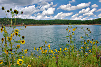
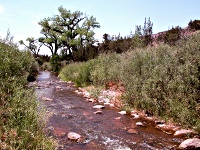
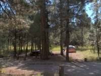
| 2015-04-27 | The page for the Red Rock Park Campground campground is now up. |
|
2015-03-07 | The page for the Agua Piedra to Indian Lake hike is now up. |
|
| 2014-04-13 | A new LookSharp! is up: See The Tents Because It Just Makes Sense! by Ben Matheson |
|
| 2014-04-13 | A new LookSharp! is up: Mining For Sunlight by Pavel Vakhlamov |
|
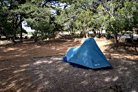
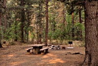
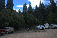
| 2013-05-03 | The page for the Morphy Lake State Park campground is now up. |
|
| 2012-07-12 | The Santa Fe National Forest is open under Stage I fire restrictions. Some areas are still closed due to the fires or the effects of the fires. In particular, many of the recreation sites in Pecos Canyon such as Holy Ghost campground are still closed. | |
| 2012-07-12 | The Cibola National Forest has lifted fire closures for Mount Taylor, and the Magdalena Ranger District. | |
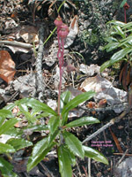
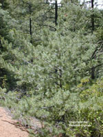
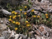
| 2012-03-11 | Diana has been working on getting more plant photos up. The following plants have new photos added: Lemonadeberry: Rhus trilobata, Mountain nettle: Urtica gracilenta, Spotted monkeyflower: Mimulus guttatus, New Mexico thistle: Cirsium neomexicanum, Common hoptree: Ptelea trifoliata, Gray oak: Quercus grisea, Apache plume: Fallugia paradoxa, Organ Mountain Larkspur: Delphinium wootonii, Common Sotol: Dasylirion wheeleri, Green Sotol: Dasylirion leiophyllum, Ponderosa pine: Pinus ponderosa, Alligator bark juniper: Juniperus deppeana, Woolly plantain: Plantago patagonica, Red brome or foxtail chess: Bromus rubens, Yellow blanket flower: Gaillardia pinnatifida, Crested pricklypoppy or scatter-spined prickly poppy: Argemone polyanthemos, California poppy: Eschscholzia californica ssp. mexicana, Soaptree yucca: Yucca elata, and Western white clematis: Clematis ligusticifolia. Whew! She has been busy! | |
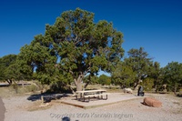
| 2011-12-16 | The page for the El Morro National Monument campground is now up. This campground is notable because it is the 50th campground described on ExploreNM. |
|
| 2011-12-09 | The page for the Villanueva State Park campground is now up. |
|
| 2011-12-11 | The page for the Kingston campground in the Black Range is now up. |
|
| 2011-12-09 | The page for the Vista Linda campground in the Jemez is now up. |
|
| 2011-11-25 | As a side effect of the new database and programs (read the news item below for more), the page for the Sumner Lake State Park Eastside campground is now up. |
|
| 2011-11-25 | As a side effect of the new database and programs (read the news item below for more), the page for the Brantley Lake State park campground has been split into two, one for the Limestone developed campground and one for the Rocky Bay primitive campground (effectively, all around the edge of the east side of the lake). | |
| 2011-11-25 | As a side effect of the new database and programs (read the news item below for more), the page for the El Porvenir campground is now up. |
|
| 2011-11-25 | As a side effect of the new database and programs (read the news item below for more), the page for the Bluewater Lake Canyonside campground is now up. |
|
| 2011-11-25 | The new campground code and database are in production. The old campgrounds are still availablea but the code and old database will not be maintained; eventually they will stop working. If you notice any problems, please use the suggestion form to let me know. I still have a to-do list much larger than the time I have available to do it, but the new database is far better designed. Also, my laptop is now the master copy of everything, so this means that I can visit a campground with my laptop and enter the data while I camp. When I get back, I push it to the server and the new data is live. Also, data for several campgrounds are more current. | |
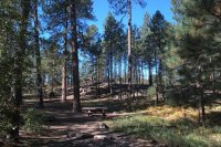
| 2010-08-30 | The page for the Grande Vista Nature Trail at Sugarite Canyon State Park is now up. This page also has an experimental use of Google Maps for the location map. Eventually, every hike and campground will use a better version of this. |
|
| 2010-08-26 | As a side effect of the new database and programs (read the news item below for more), the page for the Tsin Kletsin hike at Chaco Culture National Historic Park is now up. |
|
| 2010-08-26 | Finally! The new hike code and database are in production. The old hikes are still available, but the code and old database will not be maintained; eventually they will stop working (probably sometime after the new campground code is live). If you notice any problems, please use the suggestion form to let me know. One benefit of the new data is that the directions to the trailheads are much-improved. Also, the new database structure will allow better integration between hikes and campgrounds (e.g., what's the nearest campground to a hike or nearest hike to a campground?). | |
| 2010-06-12 | The New Mexico Independent reports that the US Park service might take over the Valles Caldera Perserve. | |
| 2010-04-30 | The database system behind the web site has been upgraded, and the upgrade process caused about an hour of downtime. The new database is a prerequisite for getting the new code running. I am slowly making progress on the new web site. | |
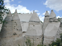
| 2010-04-01 | The road to Kasha-Katuwe Tent Rocks National Monument will be closed for paving until September 12, 2010. For more information, see the (now missing) BLM web page about the closure. | |
| 2009-12-14 | The NM State Parks has a survey on outdoor recreation in NM. It is a long survey (I filled it out). As an incentive for you to fill it out, they are offering a chance to win free camping or day use for a year at NM Parks. | |
| 2009-12-14 | The Albuquerque Journal reported that due to budget problems, some NM State Parks might be closed for a couple of days. Through March, you should check with the park you plan on visiting to see if they will be affected. | |
| 9/18/09 | Kirt Kempter will be giving a talk on The Geologic Story of Kasha-Katuwe Tent Rocks National Monument at the New Mexico Museum of Natural History and Science on Mountain road in Albuquerque Tuesday, September 22, 2009. You can get more information at the museum calendar entry for the talk. | |
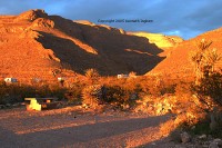
| 3/31/09 | President Obama signed legislation to protect Snowy River, a cave formation in Ft Stanton Cave, NM. as well as create the Sabinoso wilderness area. You can read more about it in the New Mexico Independent. The Las Cruces Sun-News also has article about it. |

Researchers in Snowy River, Ft Stanton Cave, NM |
| 12/26/08 | I reviewed The Best in Tent Camping New Mexico by Monte R. Parr. Note that if you purchase a book (or anything else) by using the links on the book review page, a (small) portion of the purchase price supports ExploreNM.com. | |
| 12/26/08 | The page for the Railroad Canyon hike is now up. |
|
| 4/2/08 | In case you are wondering about the slow addition of data, I am in the process of completely redesigning the web site software. The end result will be a much-improved database and more reliable and easier to maintain code. However, ExploreNM.com is a spare time activity, and I have not had much time recently. | |
| 2/2/08 | We hiked in San Lorenzo Canyon today, and updated the page for it. |
|
| 5/18/07 | Due to an increased level of spambots trying to abuse the comment form (trying to add links to unrelated sites) and the suggestion form (trying to get it to send spam), both now require that you enter a random number that comes from an image displayed on the page. The goal is to separate the humans (i.e., you) from the spambots that cannot understand what is written on the page. A human could look at the page and work out a solution involving OCR. Since link attacks fail anyway, it should not be worth their trouble. The goal is to reduce my load of having to remove their test postings (that do not include links) as well as reduce the email that I get whenever a bot bounces off the security measures. | |
| 4/10/07 | The hike page for the Dog Canyon hike from Oliver Lee Memorial State Park into the Sacramento mountains is available. This is an amazing hike, and we are happy to finally get the web page for it up. |
|
| 4/2/07 | We visited the Lincoln National Forest Three Rivers campground and were impressed. You can see what we saw yesterday (maybe the fastest turnaround for data here!). |
| 2/4/07 | The plant page for Lotebush is now up. |
|
| 1/7/07 | The plant page for Canyon grape is now up. |
|
| 1/6/07 | We are introducing a new part of ExploreNM.com: The Naturalist's corner. We wish to encourage others to experience some of the wonderful sights of the natural world that we see while exploring New Mexico. This new section takes you beyond simply hiking the trails and points out easy to miss natural phenomena that can enrich your hiking experience. Check it out! | |
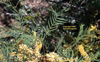
| 1/6/07 | The plant page for honey mesquite is now up. |
|
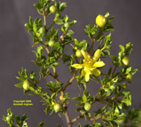
| 1/6/07 | The plant page for creosote bush is now up. |
|
| 1/6/07 | The plant page for New Mexico alder is now up. |
|
| 1/6/07 | The plant page for silverleaf oak is now up. |
|
| 1/5/07 | The campground page for the Pancho Villa State Park has been updated with new photos and information. |
|
| 1/5/07 | The plant page for the pointleaf manzanita has been created. |
|
| 1/5/07 | The plant page for the Chiricahua pine has been created. |
|
| 11/23/06 | The plant page for the Chokecherry has new photos. |
|
| 9/24/06 |
The attackers discovered the Water Canyon campground page. If you have any comments to add to it or the other sites where automatic comments are turned off, use the comment form. It will fail, but I will see the comments and manually add them. After PhD, I will re-write the comment program to better exclude the bots. Most, if not all, of these attacks are coming from compromised computers on cable and DSL Internet connections. Please ensure that your computers have the latest patches. If you run Windows, please run anti-virus and anti-spyware software with current definitions. Pester your software vendors to produce software that is secure by default. OK, off my soapbox now. | |
| 9/11/06 | The pages for the Tyuonyi Overlook hike and the Juniper Campground at Bandelier National Monument have had minor updates based on our last visit. | |
| 9/11/06 | The page for the Cebolla Mesa hike is now up. |
|
| 9/6/06 | The page for the Cebolla Mesa campground is now up. |
|
| 6/30/06 |
Due to sustained (as many as 700 per day) attacks (i.e., attempts to add links about Viagra and online casinos) against two of the comment forms (Cochiti Lake campground and the Kasha Katuwe Tent Rocks and Slot Canyon hike) direct addition of comments to these pages has been turned off. You can still add comments, but they are sent to me and I have to manually add them. When the level of attacks drops, I will re-enable direct addition of comments. Most, if not all, of these attacks are coming from compromised computers on cable and DSL Internet connections. Please ensure that your computers have the latest patches. If you run Windows, please run anti-virus and anti-spyware software with current definitions. Pester your software vendors to produce software that is secure by default. OK, off my soapbox now. | |
| 3/12/06 | The page for the Tyuonyi Overlook hike is now up. |
|
| 1/19/06 |
As you can see, I have changed the front page formatting to make better (denser) use of the screen. If you like or dislike the change, let me know via the comment form. The news page formatting also changed to mirror the news on this page. | |
| 1/19/06 | The page for the Three Rivers Petroglyph BLM campground is now up. |
|
| 1/19/06 | The page for the Three Rivers Petroglyph hike is now up. |
|
| 1/15/06 | The page for the Oliver Lee Memorial State Park campground is now up. |
|
| 1/15/06 | The Spike Verbena and Pipsissewa plant pages now have photos. The Wild Strawberry page has an overview photo. |
|
| 1/7/06 | The page for the Redondo campground is now up. |
|
| 1/5/06 | The page for the Jemez Falls campground is now up. |
|
| 1/5/06 | The page for the Cabresto Lake campground is now up. |
|
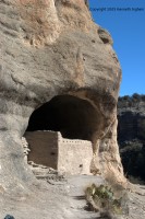
| 1/5/06 | The page for the Gila Cliff Dwellings is now up. |
|
| 12/18/05 | The Limber pine plant page now has photos. |
|
| 12/7/05 |
I have changed the way that the comment form handles some characters, and it will better identify paragraph breaks. The result should be slightly nicer automatic comments, with less work required by me to put non-hostile characters back in. Sadly, the hostile attempts exceed the real use. I also fixed a bug that was causing it to lose the city name that the commenter was from, and it put instead a mangled version of the email address. I have gone through and manually removed all of the mangled email addresses. |
|
| 9/11/05 | The hike index page is now making use of the database. The result is that you now have more sorting choices than you are likely to ever need. You can sort by start elevation, length, fee, etc. If you want to use the (now gone) /hikes/oldindex.cgi old index, it is available, but I will not be maintaining it. Therefore, at some point in the future it will cease to work. Instead of using the old index, if there is something you prefer about it, let me know via the comment form. The sorting shows that we have a few glitches in the data. I will be working on these. Unfortunately, some require re-hiking the trail to fix. | |
| 8/31/05 | We are on the new server! If you find any problems, send comments on the comment form. | |
| 8/25/05 | I believe that all of the (major :-) bugs are out of the new mapping software. The map zooming and panning works, and the database lookups are all working. A great deal of behind-the-scenes work remains (I am completely re-writing the software that drives the web site), but overall I think it is ready. Watch also for more fun features that are now enabled by the better dynamic mapping software. If you find any problems, send comments on the comment form. The old page was still available at /oldindex.shtml, but it is now gone. The move to the new (much faster) server will hopefully occur soon (it has happened!). At that time, the old mapping software will cease to work. | |
| 8/7/05 | A new version of this page (the main ExploreNM page) is almost ready. The difference between the old and the new pages is the map software---it is completely re-written. The new map software provides a more interactive map that you can zoom and pan. It will also allow us to add more map features in the future, and it fixes several minor bugs in the old system (and, undoubtably adds a collection of new ones). Feel free to check it out and send any comments on the comment form. As soon as we have finished testing it, it will replace the page you are currently reading and we will be on a new (faster) server. | |
| 6/5/05 | The page for the Tunnel Spring Loop is now up. |
|
| 4/11/05 | The Book Reviews page has a third review, this one of New Mexico Campgrounds: The Statewide Guide by Christina Frain. | |
| 4/8/05 | The Book Reviews page has been re-organized, and a second review is available. | |
| 3/14/05 |
The links page has been re-organized and it should be much easier to find things now. Also, we have started a page with book reviews (one review so far). If you click on the links to Amazon.com, any purchases you make from that click (even if they are not for the book you click on) will help support this site. |
|
| 02/21/05 | The page for the Narrows Rim Trail is now up. |
|
| 11/17/04 |
The Friends of Otero will be assisting with managing the White Mesa area near San Ysidro. They are recruiting volunteers to help with trail building, sign building, etc. White Mesa is a beautiful riding and hiking opportunity that is unmatched in NM. For more information, and to sign up to receive volunteering information, please visit the White Mesa web page. |
|
| 10/6/04 | The page for the Junebug campground is now up. |
|
| 10/6/04 | The page for the Elephant Rock campground is now up. |
|
| 10/6/04 | The page for the Fawn Lakes campground is now up. |
|
| 10/1/04 | The page for the Iron Creek campground is now up. |
|
| 9/26/04 |
The page for the Water Canyon campground is now up. |
|
| 9/18/04 |
The page for the Tres Pistolas Spring to the Embudo Trail is now up. |

|
| 9/16/04 | I just updated the data format for the campground pages. A visible result of this change is the pictures on the Camping index page. The new format for storing the data more closely matches the hikes, and will allow for more code sharing. The next benefit will be a camping index page which more closely matches the hike index page. | |
| 9/12/04 | We just hiked the Cienega Canyon to the Crest trail and the page for it is up. |
|
| 9/7/04 | We camped at Sugarite Canyon State Park over Labor Day weekend. The second page from this park is up: Lake Alice Campground. |
|
| 9/7/04 | We camped at Sugarite Canyon State Park over Labor Day weekend. The first page from this park is up: Soda Pocket Campground. |
|
| 8/29/04 | We re-hiked the Hyde Park Circle Trail. The updated page has twice as many photos, and more information about the hike. |
|
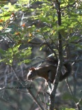
| 8/29/04 | We spent the night at the Black Canyon campground and updated the page about it with new information and a new squirrel photo. Additionally, we re-hiked the Black Canyon Trail hike, and the data has been refreshed (not many changes to this page). |
|
| 8/25/04 |
The (now gone) programs that produce the hikes sorted by elevation gain/loss and the hikes sorted by length had a bug where they generated invalid URLs for the hikes. This bug has been fixed. |
|
| 7/16/04 | Continuing the unusual speedy turnaround from data to web page, the Columbine Canyon hike page is now up. |
|
| 7/16/04 | We recently spend the night at the Columbine Canyon campground, and in a surprisingly fast turnaround, the web page for it is now up. |
|
| 7/11/04 | Up until now, the hikes were sorted by region in the state. Now, we have two new indices. You can look at the hikes by (dead link hikes/bylength.cgi) length or (dead link hikes/by_elev.cgi) elevation gain/loss. | |
| 7/6/04 | The Rim Vista hike page is up. This hike probably has some of the best views in the state. Check it out! |
|
| 1/25/04 | The Piedra Lisa hike page is available in the new format. It was available in the old format without pictures, but we re-hiked it and it too is a much-improved page. |
|
| 1/17/04 | The Cienega Loop hike page is available in the new format. It was available in the old format without pictures, but we re-hiked it and it is a much-improved page. |
|
| 1/4/04 |
The Yucca baccata plant page is finished. |
|
| 1/4/04 |
The Sulphur Canyon, Faulty Trail, and Bill Spring loop hike is now up. |
|
| 1/2/04 |
The San Lorenzo Canyon Recreation Area hike is now up. |
|
| 12/7/03 |
SEARCH! We have added a search feature, powered by Google. You can see a link to this page on the left side of the main page, and we will have a button in the navbar in the near future. Plans for this page include adding a custom search engine for hikes, campgrounds, and plants. |
|
| 12/7/03 |
All of the hikes that could be easily converted to the new format have been. Until all of the hikes have been converted, the old version of the hikes remain here. Note that the new version of the index page for the hikes now has quick links at the top to allow you to jump directly to a section. It also has a picture associated with each hike. Additionally, the new hike pages also have links to the new plant section. |
|
| 11/17/03 |
You can see the new hike format here. Only a few hikes have been converted to the new format, but we are working on this on a regular basis. |
|
| 11/9/03 |
We are redesigning the programs that run behind the web site. As a result, things will be a little wield for a few days. In particular, the plant pages are being completely redesigned and reorganized. The end result will be much better structure, but at the moment, several plant links are broken. Additionally, I am about to re-do how all of the pages for the hikes are built. The end result will be more consistent presentation and allow a search engine for hikes. However, in the short term, there will be some broken links. We are sorry for any inconvenience, but the result will be worth it. Finally, the Frijolito hike at Bandelier National Monument is now up. However, it is in the new format for hikes, and as a result is not indexed, nor does it show up when you click the map above. Both of these problems will be fixed shortly. |
|
| 10/29/03 |
The Frey Trail at Bandelier National Monument is now up. Noticing that the Jemez mountains are really in North-central New Mexico, all of the hikes and campgrounds are now listed under this portion of the state, rather than Central New Mexico. |
|
| 10/28/03 |
We camped and hiked at Bandelier National Monument. The campground page is now up. Watch for four hikes to eventually make it up as well. |
|
| 9/21/03 |
The plant page for New Mexico Olive is now much improved. |
|
| 9/14/03 |
We camped again at Gallo Campground at Chaco Culture National Historic Park, and we have added more detailed driving instructions as well as another photo. The plant page for Greasewood is now up. |
|
| 8/20/03 |
The Kasha Katuwe Tent Rocks and Slot Canyon hike in the Jemez Mountains near Cochiti Pueblo is now up. |
|
| 8/11/03 |
The Tree Spring Loop in the Sandia Mountains is now up. The Lechuguilla plant page has been vastly improved. Eventually, we will have pages like this for all of the plants. |
|
| 8/10/03 | The Peñasco Blanco and Supernova Pictograph Trail hike at Chaco Culture National Historic Park is now up. | |
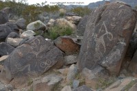
| 6/29/03 | The Boca Negra Canyon Cliff Base Trail hike on Albuquerque's west side in Petroglyph National Monument is now finished. | |
| 6/29/03 | The Boca Negra Canyon Mesa Point Trail hike on Albuquerque's west side in Petroglyph National Monument is now finished. | |
| 6/28/03 | The Old Guano Road at Carlsbad Caverns National Park is now up. | |
| 03/10/03 | A few days ago, when working on the "add comments" script, I blew it. I have now fixed the typo and it works again. | |
| 02/02/03 | The Powerline Mesa and Ancho Rapids view hike near Los Alamos is now up. | |
| 02/02/03 | The Rattlesnake Canyon hike at Carlsbad Caverns National Park is now up. | |
| 02/01/03 | The Little Bear Canyon from TJ Corral hike is now up. | |
| 01/28/03 | All hikes and campgrounds now have an option for you to leave your comments. | |
| 01/26/03 | We re-hiked the Faulty Loop Trail in the Sandia Mountains and then re-did the hike page. | |
| 12/19/02 | The Rinconada Canyon hike near Albuquerque now has photos. | |
| 11/29/02 | The Purgatory Chasm loop hike in the Gila Wilderness is up. | |
| 11/29/02 | The Pueblo Alto Loop hike at Chaco Culture National Historic Park is finished. | |
| 11/29/02 | The Chaco Canyon Overlook Trail hike at Chaco Culture National Historic Park is now up. | |
| 11/24/02 | The Thunder Egg hike at Rockhound State Park is now up. | |
| 11/8/02 | The Cedro Peak hike page is now up. | |
| 10/1/02 |
The Cienega Loop hike page is now up. Unfortunately, I appear to have lost the photos, so this page has no pictures. I will re-hike it in the spring and get new photos if I cannot find the ones from last time. | |
|
Copyright © 1997-2018 Kenneth Ingham Consulting, LLC.
For details about the copyright, see the full Copyright statement.
Unhappy? Thinking of suing us? Read this disclaimer.
You can read our privacy statement.